Wednesday, February 18, 2015

The Quitu Culture


We arrived in Quito on February 18th and set about finding our new hotel, La Rosario, which we had booked online. The hotel was up an annoying hill that we had to take taxis in and out of, but the hotel itself is quite nice – it reminded me of a spa when we first walked in. Colin and I headed to McDonalds for some food while discussing arranging my flight and tour to the Cuyabeno reserve in two days time. The following morning of the 19th I headed off to see some ancient ruins around Quito city, while Colin went to the agency’s office to pay for my Cuyabeno tour. I took a taxi from La Rosario to the bus station, then jumped on a bus 2 hours out to the Pichincha province 3100 meters above sea level to see the largest Pre-Columbian ruins in Ecuador, known as Cochasqui.

I arrived in a nearby town called Cayambe and took a taxi for $15 USD (round trip, plus waiting time for my visit) to the ruins. I found out later that there is a much cheaper way to do this, taking a bus for $1 USD from Cayambe which goes to Malchingui and drops you off at the entrance to the ruins – but I didn’t know this at the time. You can get a bus from Malchingui down to the highway as well from where you can flag down a return bus to Quito. Once I was at the site and had paid my entrance, I joined a group tour which was just leaving and started exploring the site with our Spanish-speaking guide.    

We could see the outline of the ancient pyramids. These pyramids had been built out of a hard volcanic-ash material known as cangahua, a Quechua word meaning “hard land.” The pyramid structures were originally built by an agricultural culture now known as the Caras, likely as a religious center. The Quitu culture, a dominant force in the area, eventually intermarried with the Caras (as they could not conquer them outright) and the resulting Quitu-Cara culture then used the area as an observatory, but possibly still as a religious center as well.

The pyramids were built by the Quitu-Cara culture during what is called (after the site’s name instead of the culture’s) the Cochasqui period I in 950-1250 BCE and the Cochasqui period II in 1250-1550 BCE, sticking up from the overgrown grass over a 200 acre area. There are 15 different pyramids and at least 14 tombs located here, 9 with ramps. A few of the pyramids had been a bit more uncovered than others, with overhangs built to protect what had been exposed for tourists to see. One of the pyramids, pyramid 5, is one of the best preserved and in the shape of a scorpion. Inside pyramid 5 numerous ceramic pots were found along with 575 human mummified heads.

We walked further to one of the exposed area which was the supposed ancient astronomic observatory our guide spoke about. This use is hypothesized because certain parts of the pyramid structures seem to be laid out in astronomical calendar patterns. Some of the pyramids had cut-outs on the floors inside the buildings. Inside these cut-outs, smooth, polished rocks in an oblong shape have been found. Perhaps these were markers or counters of some kind, no one is sure.

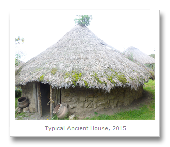
After the pyramids we made two more stops – one in a museum with Cochasqui period pottery found in graves around the site, and another a replica house from the period. Inside the replica house were different examples of toys and games that children used to play, some of which were found buried in their graves with them. Once I had finished up I met my taxi driver and asked him to drop me at a bus stop for Quito. Though he drove me nearly back to Cayambe rather than one of the much closer stops (I got a bit of a ‘duh’ of a taxi driver) I made it in the end.   

It took ages but I got the bus back to Quito and got off at the stop La Florida. I entered the taxi just as it started pouring rain and gave the driver directions. Turns out, the driver didn’t know how to get anywhere close to the site, and it took more than 30 minutes to get up a simple (but a little long) hill to the site which was just under the climb up to Quito’s cable car near the eastern side slope of the Pichincha volcano.

Just before 3:00 pm I arrived at the La Florida ruins. La Florida consists of 6 tombs of the Quitu culture people which have been designed as 12.5-15.1 meter deep shafts, and have been radiocarbon dated to 340 CE. The site was quite small, but the pieces on display were incredible, as it is supposed by the finding of emerald beads and fine textiles that the tombs belonged to quite high status individuals. Each grave had a high status ‘principal’ burial within it, along with other ‘companions’ to the high status individual and human sacrifices that had likely been buried alive according to their positioning. Many of the graves had replicas of bodies inside, placed in the way there were found originally buried. One of the graves was grown over with plants, due to the microclimate created by the location of the grave and its uncovering.

After seeing the replicas I headed back into the museum. My guide showed me a news article with a drawing of two faces on it. It turns out that the archeologists had commissioned drawings which reconstructed what the ancient people’s faces would have looked like, based on the shape of skulls that had been found at the site. Also found were some clothing made of spondylus shells – two stunningly intact ponchos which had been buried with the bodies. There were jewelry pieces, along with little bits of gold, including some which had been used for throwing arrows and spears.      

I asked the taxi driver to take me to Rumipamba Archeological & Ecological Park next, a 32 hectare site which had both animals and nature walks, along with ancient ruins and burials. The site was almost closed, but I did manage to find one of the student guides working there to take me around. She wasn’t too keen because of the rain, but took me around anyways. We went into the museum first, which housed the artifacts found in various graves on the site, from what is called the Quito culture.

The Quitu people inhabited the Rumipamba site for thousands of years –during the Late Formative Period (1500 BCE to 500 BCE), the Regional Development Period (500 BCE to 500 CE), and the Period of Integration (500 CE to 1500 CE) – there is evidence of pottery, tombs, and villages from each of these periods at the site. There are more than 25 tombs related to the Period of Integration alone! Since there is also evidence of nearby volcanic eruptions, by Pululahua Volcano and Guagua Pichincha Volcano, the area has not been occupied continuously, but in stages. My guide explained to me that many of the Quitu culture excavated homes I was viewing also doubled as burial sites for the family’s dead. It looks like when someone died in a Quitu household, they simply buried their body under the dirt of the living room floor. The last home/burial site we viewed was the oldest in the area – estimated at more than 3,500 years old.     

I found a taxi to take me back to the hotel, where I was able to relax after the crazy, long day I had. I had to pack as well - the next morning I was flying out early, off north to the Cuyabeno Reserve in the Amazon!

Francesca

Tuesday, February 17, 2015

Quilotoa And Latacunga


On the 17th February, we left Ambato and headed North back along the road to Quito in our journey towards Colombia. We got to a city called Latacunga where we took a small local bus around what is called the Quilotoa Loop. Named after a village on the loop, this mostly touristy route circles around through mountainous and forested regions through numerous villages and past several pleasant attractions.

We decided to visit one of them – the Quilotoa crater. This crater is now surrounded by tourist shops, restaurants and hotels, but is not as welcoming as it sounds. From the moment we arrived the people were trying to rip us off with inflated prices and nonsense. We managed to get to the crater however, and we were pretty impressed. The crater is over 2 km wide and filled with glistening blue water in the sunshine of the Andes. Formed over 800 years ago when a volcano collapsed, nowadays it is possible to bathe in the waters, kayak, and even hike around the rim.

We decided not to leave any of our tourist dollars in a place filled with hideous locals who were so greedy, and so we made our way back to Latacunga. We had seen enough mountains already anyway.

Latacunga was OK, but the fact that it was still carnival time for some people and they were still spraying water on every was annoying. We did try some of the local food which we found to be fairly interesting – chugchucara. This consisted of fried pork, plantains, meat empanadas, and, strangely enough, popcorn. All of this and the local spicy aji sauce made for a nice dinner.

We stayed in the main hostel in town, and noticed, disturbingly, that the trend for backpackers to spend all of their time on their gadgets rather than talking to each other had fully taken over – as had the worrying fashion of people dressing like douchebag hipsters.

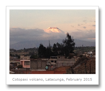
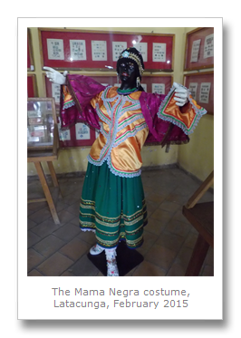
We made our way to a few local attractions – but there was not much to see in Latacunga. The casa de la cultura held some old antiques, and some models of the local fiesta de la Mama Negra. This carnival takes place twice per year, and is a mixture of both Spanish and African influences. It venerates the Virgin Mary as she is said to have stopped an eruption of the Cotopaxi volcano in 1742. It is not made clear how she stopped it, or why she did not bother to stop it the 50 times it has blown since then, but that is faith for you. Total crap. The carnival has a parade of course, and the Mama Negra is the person who passes through last. They have their face blacked up and they throw milk over everyone, so typically South American and strange.

When we were in Latacunga it was Ash Wednesday, were everyone fasts and a cross is drawn onto everyone’s forehead at mass. This gave the town a creepy feel, and gave me an excellent idea for a short story. We found a bus going to Quito pretty easily and we left later that day. Maybe next time we pass by this way (by car), we will do more in the National Parks of Ecuador, and try to drive the whole of the Quilotoa Loop.

Saturday, February 14, 2015

The Festival Of Fruit & Flowers


We spent Valentine’s Day, February 14th, figuring out how to get to Ambato from Mindo. We left early in the morning on the 14th, but just missed the direct bus out of the Mindo town center. We had to get a taxi up to the highway (which some local woman hitched on to, but we, as foreigners, were expected to pay) to flag down a bus heading to Quito. The whole day (and traveling such a distances with our many bags) was pretty insane, as once we made it back to Quito we found a shared taxi to the second bus terminal on the other side of the city… only to find out when we got there that the buses were all completely full.

Since all the locals were on holiday due to the Carnival there were lines dozens of people long waiting for non-existent buses (the bus company told us if they could FIND another bus, then there would be another one going that day) and hundreds of people in the bus station trying to get out of Quito. We got lucky and found an overpriced car share with another couple to bring us all to Ambato. There were many road diversions and the drive was stop and go, but we got there in the end by 3:30 PM and back to our hotel we had previously reserved. I relaxed in the room while Colin got us some lunch and a Valentine's balloon for me!

While Colin set about doing some work, I headed out to see some of the festival straight away. I got to see two floors of interesting rooms in a house called the Museo Provincial Casa Del Portal, which was just near the city park. These exhibits included some paintings, but mainly giant sculptures of flowers arranged in different ways – some in the shapes of animals such as hummingbirds or frogs, some with bicycles, some simply displayed as arrangements on their own or along with dining room table decorations. There were competitions set up and as people walked around they could see how the judging of each category went as the different colored ribbons for winners were on display.

 
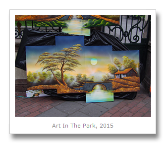
I exited the house to explore the rest of the festival. There were pieces of artwork set up along the gates of the city park. Every other corner had venders selling colorful clothing and accessories, or some steaming hot snacks. The centerpiece of the area was the massive flower Jesus display that had been set-up just outside of La Catedral de Ambato.

As the evening began I realized I was going to be running late for the free dance show I was eager to attend. I jumped into a tax and rushed off to a nearby arena and claimed my seat just before the announcements began. The show started by introducing the audience to the winner of the ‘Queen of Ambato’ contest – a beauty contest for one young woman to represent her city for the year and the festival. Earlier in the day I had seen one exhibit room filled with the portraits of all the ‘Queen of Ambato’ winners from when the competition first began up until the present one. In 2015 the winner was a woman named Nicole, who came out in her fancy white dress and sash waving to the crowd.

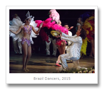
I bought some chocolate covered strawberries, popcorn, and soda and settled down to watch a couple hours of dancing by representative professional dance groups from Bolivia, Brazil, Ecuador, Columbia, Peru and Mexico. Overall, the Columbian dancers were by far the best with their rapid movements and incredible talent. Each of the groups completed some traditional dances in their traditionally colorful clothing, but modernized with sparkles and some sex appeal. Towards the end of the evening Colin managed to find me in the crowd at the event and we watched the last couple of dances together!  


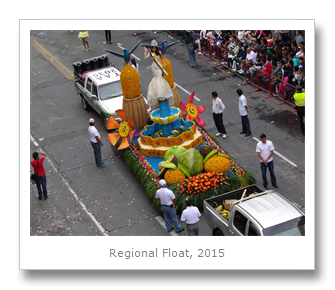
The following morning, February 15th, was the main parade of the event! This parade or ‘Carnival’ was completely different from the one we experienced in Brazil, but much more comfortable to experience as I watched it from out the window in one of the hotel’s rooms! I had a perfect view! Led by the festival’s Queen Nicole, this parade had loads of different floats in it, all made in some way out of pieces of fruit and colorful flowers. Each float had a couple of glamour girls ‘decorating,’ it, blowing lots of kisses to the crowds. Before and after each float were dancers in creative costumes related to the theme of the float.  

In the afternoon after the parade I headed out to see a few more of the free programs on in Ambato. I tried a bunch of free food samples and shopped a bit more, but I was really interested in seeing some of the museums for free. The museums included a history museum with loads of stuffed birds and animals… even some deformed animals such as a two-headed calf and a deformed ‘frog-like’ baby corpse.

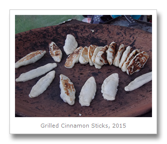
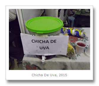
That evening (after a quick return to the hotel around the time it started to rain) I went out to one of the night fairs. While I was waiting in line to buy my ticket, I got to see a great view (although between some buildings) of the massive Volcano Tungurahua. I paid and went in, eager to try some of the local specialty foods such as ‘uva chicha,’ or chicha made from fermented grapes instead of the more typical fermented maize. Tasted like grape juice with a slight bit of acidity in it. One woman was cooking some fried dough with cinnamon inside it and I tried a few of those as well (really nice.) Outside there was a big BBQ going on, and lots of agricultural booths with various things for sale such as saddles, fertilizer, tractors, cows. The best was the group of show horses, one of which preformed for the audience.

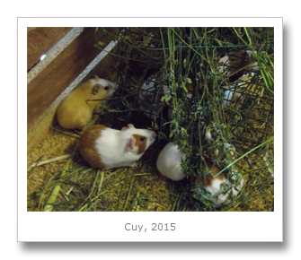
Before I returned home I watched a pizza being made and bought a slide with guinea pig on it (cuy) and some chocolate-covered strawberries on a stick for Colin as a little post-Valentine's Day treat.

Monday morning was a daytrip a few hours away to enjoy a scenic train ride and lunch we had set up a few weeks previous our first time in Ambato. We met our group outside the agency, (we went with the pretty decent Darvitur for $60 USD per person) and piled into the car. It took a while to get going but once we got out to the city of Alausi (named after the saint ‘San Pedro de Alausi’) the views were stunning. Our first stop was at a huge statue (built by the Ecuadorian artist Eddie Crespo) of the city’s patron saint, San Pedro. The city has houses more than 100 years old still standing, and is most known as the starting point for the Nariz del Diablo train we were about to jump on.

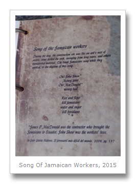
The Nariz del Diablo train is an incredible engineering achievement, built with a political purpose in order to carry the riches of the coast to the sierra. Previous to the railroad it took 2 weeks to get a product from the coast to the sierra, and was completely impossible a journey in the rain. Purchasing the rail tracks from London, the Ecuadorians began measures to shorten this arduous journey. Through multiple Presidential terms starting in 1873 the railroad was worked on, finally completed in 1902. Brought in to to work on the railroad were 4,000 Jamaicans, 240 Puerto Ricans, and 204 from Barbados. It was believed that these workers would be more resistant to tropical climate and diseases. 500 colony prisoners were used, promised their freedom in exchange for their labor, and some indigenous – however, they were frequent deserters of the rail project during planting season.

In its construction, the train line connected Quito with the coastal city of Guayaquil, opening Ecuador up to trade and investment from the rest of the world. Specifically the trains moved cotton and wool from the haciendas and brought products from the city to the countryside. Many people, mostly Jamaican slaves, died in the process of its construction. It was also said that there used to be many condors living around the area, but that they were scared away during the train’s construction due to the loud explosions of dynamite. Moreover, the difficult topography of the Andes combined with the rainy climate made the construction of the train become known as the ‘most difficult train in the world.’ Up to 96,000 cubic meters of material were required for each 1.6 kilometers (1 mile) of railway built – an incredible amount. All of the fear and death associated with the area, as well as the shape of one of the mountains the train passes by, is why the place has become known as the “Devil’s Nose.”


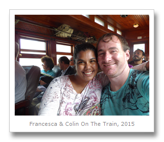
At Sibambe station a snack and museum were waiting for us. We were first greeted by a group of dancers, who were already shaking to music when the train pulled up. I checked out the museum (up a load of stairs) while Colin stood in line for our snack plates.

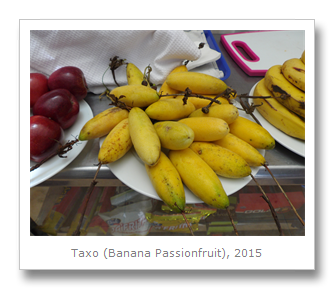
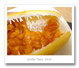
While we were at the top of the viewpoint I spotted some strange fruit I wanted to try. The first looked like a small banana, but was in fact a more ‘hollow’ fruit called taxo or banana passionfruit. This fruit is native to the South America, specifically in the the Andean valleys between Venezuela and Bolivia. I bought one of these fruits and tried some of its inside – which was a bit sour and had loads of hard seeds in it you were just supposed to “chew through.” Neither Colin nor I were fans. I also saw an orange passionfruit called granadilla – we’d tried this one before and weren’t keen on wading through more seeds for some fruit.

We took our seats on the train again and headed off. Before the train turned around to head back to Alausi we had to go through its infamous switchbacks in order to get on the right track back. Since the mountain is too narrow to have the train go around too many curves, in the construction of the train extra bits of track were added. The train could then drive up onto and sit on these tracks while the train’s angle was being rerouted be a manual lever. We watched as a guy jumped off the train and changed the direction of the track so the train would head back down. Now the train could start moving again, this time on a new bit of track. Very clever – and really cool to watch! 

We had a fantastic lunch stop after the train ride. Though it was typical ‘set menu’ lunch food (soup, meat, rice) there was loads of it and it actually tasted pretty nice! We even got loads of bread and a dessert called ‘panela’ to go along with it. Colin really enjoyed the panela- it was a sugar cane dessert- and he ended up eating both of ours! 

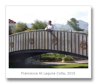
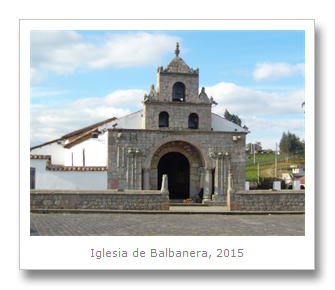
On the way back to Ambato our group stopped for some photos and time exploring a lake and church. The lake, named Laguna Colta (or Duck Lake) had a little island in the middle of it you could walk out to, and some birds swimming around in its waters. The small and quaint little church is named Iglesia de Balbanera and it is the oldest Catholic church in Ecuador, built by the Spanish in 1534. On the inside of the church was a painting of the area when it was hit by an earthquake in the 1790’s. After our group finished at the church (and found a couple of lost group members) we packed in for the long ride back to Ambato. The traffic was quite horrible, but we had some afternoon snacks (fruit juice and cookies) to keep us sane. We were lucky and had some great views of volcanoes along the way – Volcano Chimborazo and Volcano Carihuairazo on our left and Volcano El Altar and Volcano Tungurahua on our right.   

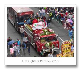
In the evening after our daytrip was a second parade. Since there was so much traffic trying to get into the city of Ambato that evening coming back from our daytrip, I was a bit worried about being late for the parade. However, I ended up with two things which required no worry at all – we arrived back in the hotel with many minutes to spare… and the evening parade was almost the same parade as the morning one I had already seen! There were a few minor differences – the night parade was a bit bigger because it had some school groups (such as marching bands and cheerleaders) in it as well, plus more promotional flashy attractions (the start were a bunch of flashy cars with stereo systems playing) but not much different otherwise. Here are a few other photos I got then:  


The following morning Colin and I had our breakfast at the hotel, then packed up and left Ambato. We had decided to head out to try and see a breathtaking crater lake! On to Colin for that one!  

Francesca